Habitats monitoring network

As monitoring biodiversity in habitats relates to small sampling areas, the method calls for fieldworkers to proceed in a particularly meticulous fashion. Using the BDM smartphone app, plant species are recorded directly on the spot. Mosses and gastropods, however, are preserved and passed on to experts for identification.

Procedure

‟Impression

In order to monitor vascular plants, mosses and gastropods in habitats, fieldworkers first localize each 10 square meter sampling site by means of a GPS device and a magnetic locator. Once the magnet buried at the center is found, the sampling site is delimitated using a piece of string of 1.8 meters of length.

Using the BDM smartphone app, plant species are recorded directly on the spot. While this usually eliminates the necessity of transferring field notes to a computer, some plants need to be collected for subsequent identification. Mosses and gastropods are always passed on to experts for identification.

Sampling area

‟The

The circular sampling area for terrestrial habitats is 10 square metres and is highlighted in orange above for clarity.

Monitoring network

‟Relief

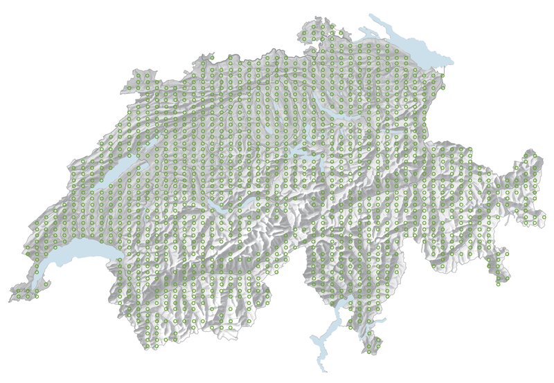
The monitoring network for biodiversity in habitats comprises around 1450 measuring points, each 10 square metres in size. A distinction is drawn between forest, meadows and pastures, settlements, fields, alpine pastures and mountain areas as habitats. Vascular plants, moss types and snails are monitored.

Step by step

The photo series follows a BDM employee on a visit to a sampling area. Click on the pictures for a larger view.

  • The field worker uses a yellow magnetic locator to find the centre of the sampling area.
    1
    The BDM field worker locates the sampling area using GPS and a magnetic locator. A magnet is buried at each area’s center to make sure it can be found again with utmost precision every 5 years.
  • The picture shows how the field worker measures the radius of the sampling area using a string attached to a wooden stick.
    2
    With a piece of string attached to the center post helping to keep the predefined radius, the BDM fieldworker identifies all vascular plants growing in a circular area of 10 square meters.
  • The botanist enters the species found into the smartphone.
    3
    She records all plant species she has identified in the dedicated BDM smartphone app.
  •  Botanist looking through the orange Bussole, a surveying device that allows the exact direction of the compass to be determined.
    4
    Using a surveying compass, the fieldworker selects 8 spots at the edge of the sampling area for soil samples.
  • The field worker has taken a soil sample. The excess soil material is removed from the sampler with a trowel.
    5
    A standardized soil sampler cuts a square 125-cm2 sample of litter and topsoil down to a depth of 5 centimeters.
  • The soil sample is packed in a white carrier bag.
    6
    Soil samples are bagged and later sifted through in the lab to find any gastropods shells contained.
  • Kneeling on the ground, the botanist looks through the magnifying glass in search of mosses.
    7
    Finally, the sampling area is assessed for mosses.

Methodology guides

The methodology for the field and laboratory work is described in detail to ensure a standardised procedure. The corresponding methodology documents are publicly accessible.

Monitoring networks at a glance

Find a descriptive overview of the BDM monitoring networks online.

Watercourse monitoring network

Field workers survey aquatic invertebrates over a section of 5 to 100 metres in length, depending on the width of the watercourse. The animals are collected for identification in specialised laboratories.

Landscapes monitoring network

Field workers record the plants, butterflies and breeding birds over an area of one square kilometre. They generally follow a precisely defined route along paths and roads.